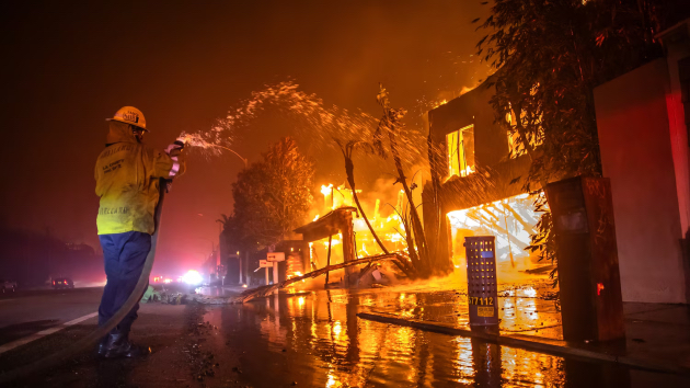
(LOS ANGELES) — Hydroclimate whiplash — the rapid shift between wet and dry conditions — likely contributed to the severity of the wildfires burning in Southern California, according to experts.
In recent years, parts of the state shifted from a major drought to an extended period of above-average precipitation that allowed for abundant vegetation growth. After that, a stretch of intense, record-breaking heat dried out much of that vegetation and provided ample fuel for large and fast-growing wildfires.
The Los Angeles region experienced two “extraordinarily wet” winters — in 2023 and 2024 — followed by dry conditions that began in February, Edith de Guzman, a water equity and adaptation policy cooperative extension specialist at the University of California, Los Angeles, told ABC News. Since May 6, Los Angeles has only seen 0.16 inches of rain, so the region’s rainy season is off to an unusually dry start.
“Right now, we essentially have had no measurable precipitation since last spring, which has dried out all of that vegetation that grew happily over the last two wet winters,” De Guzman said.
The shrub cover that popped up as a result of the extra precipitation later dried out — providing large volumes of fuel for a fire, De Guzman said.
Combined with the highly flammable materials many of the houses were constructed with, such as wood frames, it was a recipe for disaster, De Guzman said.
In Southern California, dry conditions are also now more likely to last later into the fall, leaving the region more vulnerable during high wind events, according to Daniel Swain, a climate scientist with both UCLA and UC Agriculture and Natural Resources.
“Climate change is increasing the overlap between extremely dry vegetation conditions later in the season and the occurrence of these wind events,” Swain said.
Hydroclimate variability has always been a staple of California’s natural climate, leaving it particularly vulnerable to wildfires.
Among all of the states in the continental U.S., California has the most year-to-year variability between wet and dry conditions.
“As you move down into Southern California, that variability increases even more,” Julie Kalansky, climate scientist and deputy director of operations at the Center for Western Weather and Water Extremes at the University of California, San Diego’s Scripps Institution of Oceanography, told ABC News.
However, some climate experts point to growing evidence that shows climate change has increased the volatility between very dry and very wet conditions around the world, like moving from a devastating drought to record-breaking precipitation and then back to a drought. These rapid swings between extreme weather events will amplify many of the associated hazards and contribute to devastating wildfire events.
Climate change could also be making wild weather swings more common and more extreme, according to new research published in Nature Reviews Earth & Environment and the Fifth National Climate Assessment, a breakdown of the latest in climate science coming from 14 federal agencies, published in November 2023.
“These hotter, dry conditions that are driven by climate change have created a tinderbox,” said Rachel Cleetus, policy director for the Climate and Energy Program at the Union of Concerned Scientists. “We have this dried out vegetation, very dry landscapes.”
But hydrovariability alone didn’t lead to the devastating fires over the past week. A “confluence” of events allowed the fires to explode instantly, Cleetus said.
It was the wind that spread the fires so rapidly once they were ignited. An exceptionally strong mountain wave wind event, with northerly 80 mph to 100 mph gusts, spread the fires faster than anyone could stop them.
“We experienced the most intense Santa Ana winds in nearly 15 years,” De Guzman said.
Conditions higher up in the atmosphere helped to further enhance winds at the surface.
Cold, dense air associated with a low pressure system in the upper atmosphere was moving over Baja California. That air was positioned at a favorable north-northeast to northeast trajectory over the region allowing for the colder air located higher up in the atmosphere to come rushing down towards the surface and enhance the winds already blowing.
This brought surges of powerful winds across the Los Angeles and Ventura County Mountains — including in some places that don’t typically see winds that strong, like Burbank and in the foothills of the Pacific Palisades.
The wind direction and topography played a major role as well. The San Gabriel Mountains and the wind orientation interacted to produce a damaging wind event that doesn’t occur often. The mountains can also make the winds more erratic because additional whirls of wind, known as wind eddies, can form as the air moves across the peaks and through the canyons.
“They were extremely strong and fast, but they were also erratic,” De Guzman said. “They typically are narrower and a little bit more predictable in direction.”
ABC News’ Matthew Glasser, Dan Manzo and Ginger Zee contributed to this report.
Copyright © 2025, ABC Audio. All rights reserved.
